In a tripartite collaboration that is expected to improve driver and road safety technologies in the country, Union Ministry of Road Transport & Highways (MoRTH), IIT Madras and MapmyIndia have signed a Memorandum of Understanding (MoU), and have jointly launched an indigenously developed, free-to-use navigation app service.
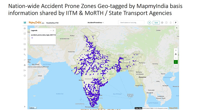
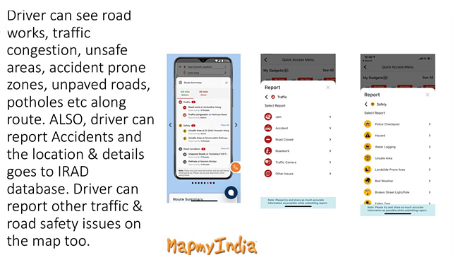
The MapmyIndia app, enhanced with the support of MoRTH and IIT Madras, provides road safety alerts to users about upcoming accident hazards, while driving. By using this navigation app, users will get voice and visual alerts about upcoming accident-prone zones, speed breakers, sharp curves, potholes etc, to ensure they can drive carefully and avoid accidents.
The app would further allow users and authorities to report and broadcast accidents, unsafe areas, road and traffic issues on the map to help benefit other users. These would be further analysed by IIT Madras and MapmyIndia, and will then be used by the Government of India to improve road conditions in future.
The three-way collaboration represents the best of the public sector, academia and private sector coming together to offer a world-class, locally relevant, indigenous solution, said MapmyIndia in a release.

It must be noted that MapmyIndia won the Government of India’s Attmanirbhar App Innovation Challenge in 2020.
The app offers a myriad of mapping, navigation, safety and hyper-local features to help users. The company has appealed to all government organisations at central, state and local levels such as transport, public works, road and traffic departments and authorities to use the app to report and broadcast information about accidents, poor traffic or road conditions, road works etc., so that users can be quickly alerted about potentially dangerous areas.